Greene
Greene County
The county was named for Nathaniel Greene, a Revolutionary War Hero. The first settler, Thomas Davis, came in 1849 and settled close to the present town of Rippey and near the Raccoon River, just south of Squirrel Hollow.
In 1864, Greene County was organized and by 1856, the first courthouse (known as the “Red Brick” courthouse) was built on the town square. Prior to this, Judge Phillips held court in a log cabin located southeast of Jefferson. The present courthouse was dedicated in 1917 and is listed on the National Register of Historic Places.
Outside of the courthouse, on the town square, is a statue of Abraham Lincoln. It was a gift from local resident, E.B. Wilson, to honor the first highway across the United States. It commemorates the Lincoln Highway which crosses east to west through Jefferson and directly in front of the monument.
www.co.greene.ia.us
Towns on the Lincoln Highway
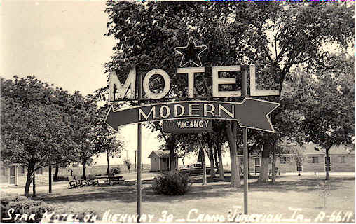
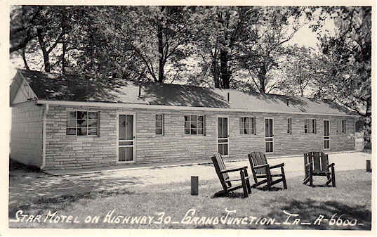
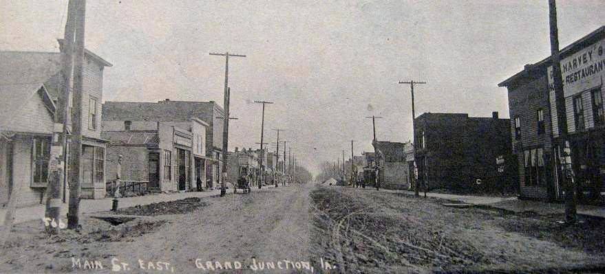
Grand Junction
Grand Junction was aptly named because the Chicago, Milwaukee, and St. Paul Railroad and the Iowa Central (later known as the Minneapolis and St. Louis) railroads formed a junction here. Two years after the Cedar Rapids and Missouri River railway came through on an east to west route, a north/south rail line was built from Keokuk to Ft. Dodge. It became evident where they crossed would make a good location for a town. But the “lay of the land” did not cooperate. In the rainy season at least half of the surface was under water. Land owners adjacent formed their own towns (Central Grand Junction, South Grand Junction, and West Grand Junction.)
The residents depended on the rail road for jobs and the hoped that a branch from Grand Junction to Sioux City would afford more businesses to locate here and they would have a permanent demand for employees. The Chicago, Rock Island, and Pacific Railroad took possession of the line and moved it to Valley Junction. Growth at Grand Junction came to a halt after having peaked at a population of 444. Coal was found near the center of town and under that, an 8-foot strata of excellent potter’s clay. Goodwin Brick and Tile found a home in Grand Junction for a while and Grand Junction once was known as having the largest egg packing plant in the world. http://files.usgwarchives.net/ia/greene/history/grandjunction.txt
Today, visitors can learn more about the Lincoln Highway at the Lincoln Highway’s Museum, open daily and Sunday by appointment (515-370-3738) or at the Lion’s Tree Park on the northeast edge of town. The Higgins Museum and the Fire Department Museum are open by appointment only and the Kennedy Museum is open mornings or by appointment. Spring Lake is close by for camping, fishing, swimming, concessions, and it even offers boat rental. The Hilltop Wind Farm is near Dana, but can be seen from a distance. The Solar Farm provides energy for the community center.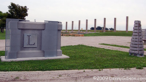
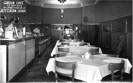
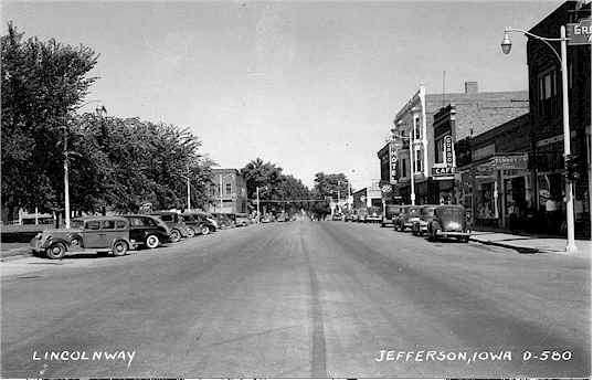
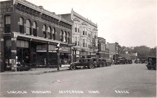
Jefferson
In 1849, the first family (with 6 children) moved up the Raccoon River Valley from Adel and built a cabin. Very shortly more families joined them. Jefferson was named in honor of Thomas Jefferson by the commission selecting the site as the county seat. Initially it was called New Jefferson to avoid confusion with Jefferson in Dubuque County. After that town failed, it dropped the “New” from the name.
Today, the sites in Jefferson to see include the Mahaney Bell Tower, rising 14 stories above the Iowa farmland. A glass elevator will take you up 120 feet where you can see 5 counties on a clear day and see the Lincoln Highway as a ribbon running through the town, through the countryside and disappearing into the horizon. (Corner of N Wilson Ave and E Lincoln Way, phone: 515-386-2155)
The Greene County Historical Museum at 219 E Lincolnway (515-386-8544) has many displays and artifacts about the early years of the county and the county seat, Jefferson. 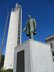
The Jefferson Gardens are along Lincolnway, near the town square. The Telephone Museum is 1 block south of the square. Also within walking distance of the square is Sally’s Alley, a quaint pocket park complete with benches, plantings and “little library”. The Doreen Wilbur statue is just down Lincolnway and pays homage to the Olympic Gold Medalist archer (Munich, 1972). Visitors can check out RVP~1875 and their handmade furniture or stop into Stitches Quilt shop. Jefferson also has rooftop art and a Milwaukee Depot at the east end of Lincolnway.
Nature lovers can visit Squirrel Hollow on county road P30, the second oldest county park in Iowa. It offers camping, fishing, canoeing, kayaking, hiking, picnicking, and equestrian camping and trails. In the fall, Deal’s Orchard allows visitors to pick their own apples or pumpkins, ride a hayrack ride, and go through a corn maze. In December, visit Deal’s Tree Farm and pick out your own Holiday Tree.
The Hardin wind farm is north on Hwy #4, but be seen from a distance.
The newest attraction to Jefferson is the Wild Rose Casino, which opened in 2015 and offers a restaurant (Coaches Bar and Grill), a hotel (Cobblestone), a variety of entertainment, and gambling.
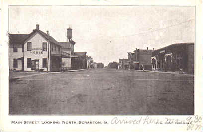
Scranton
Scranton was first known as Scranton Center and was named for the town of the same name in Lackawanna County, PA. That town was named for Joseph H. Scranton, one of its founders. He owned a steel mill and furnished many of the railroad ties for the Chicago Northwestern Railroad. The Cedar Rapids and Missouri Railroad came through Scranton, Iowa in 1866.
The town has the oldest working water tower in Iowa and the 9th oldest in the nation. An interesting event happened in Feb 1907, when the water froze in the town mains. The townsfolk decided to light a fire under the water tower and melt the water. The fire got out of control and flames surrounded the tower. Men climbed up the tower to try to throw water down on the fire, but instead fell into the water tower. Due to the cold and wet, they were too weak to pull themselves out when thrown a rope. Howard Butler, 21, lowered the men down and became a town hero. www.scrantoniowa.com
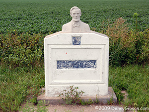
Today, visitors can still view the working water tower and see a 1930’s Standard gas station or stop by the Eberle station on Highway #25. There is an original Lincoln Highway Association marker at the gazebo on Main Street. Hyde Park offers camping and fishing and Dunbar Slough, a state wildlife management area, provides habitat for many native Iowa wildlife and is an excellent place for birdwatching.
Ralston
This town is partially in Carroll County and partially in Green County and was named for W.C. Ralston of California, a well-known personality when the town was formed.
Today REG has a 12 million gallon, commercial scale, state-of-the-art biodiesel production facility in Ralston. www.regfuel.com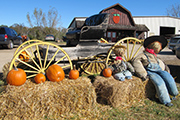
Lincoln Highway and Greene County
Greene County has a long and well documented history with the Lincoln Highway. The road was a dream of Carl Fisher’s and with the help of Henry B. Joy, the president of the Packard Motor Company, they formed the highway from existing roads, dirt roads, and wagon trails.
From the start of the federal government until the “Good Roads” movement in the late 1880’s, road building and maintenance was considered functions of the local government.
Federal money funded just a few roads, mostly in the east and along the Ohio River or military roads like Dubuque to Iowa City or Mt. Pleasant to Keosauqua.
States that were admitted between 1803 and 1910 were given allocations from federal land sales to be used for public roads, canals, and internal improvements. Iowa spent the money on schools, not roads. After Rural Free Delivery (RFD) mail service was introduced in 1896, the Office of Public Roads began to provide technical assistance for building and maintaining rural post roads. In 1904, Greene County’s roads were sufficiently graveled and maintained to enable it to become the first county in Iowa to receive RFD.
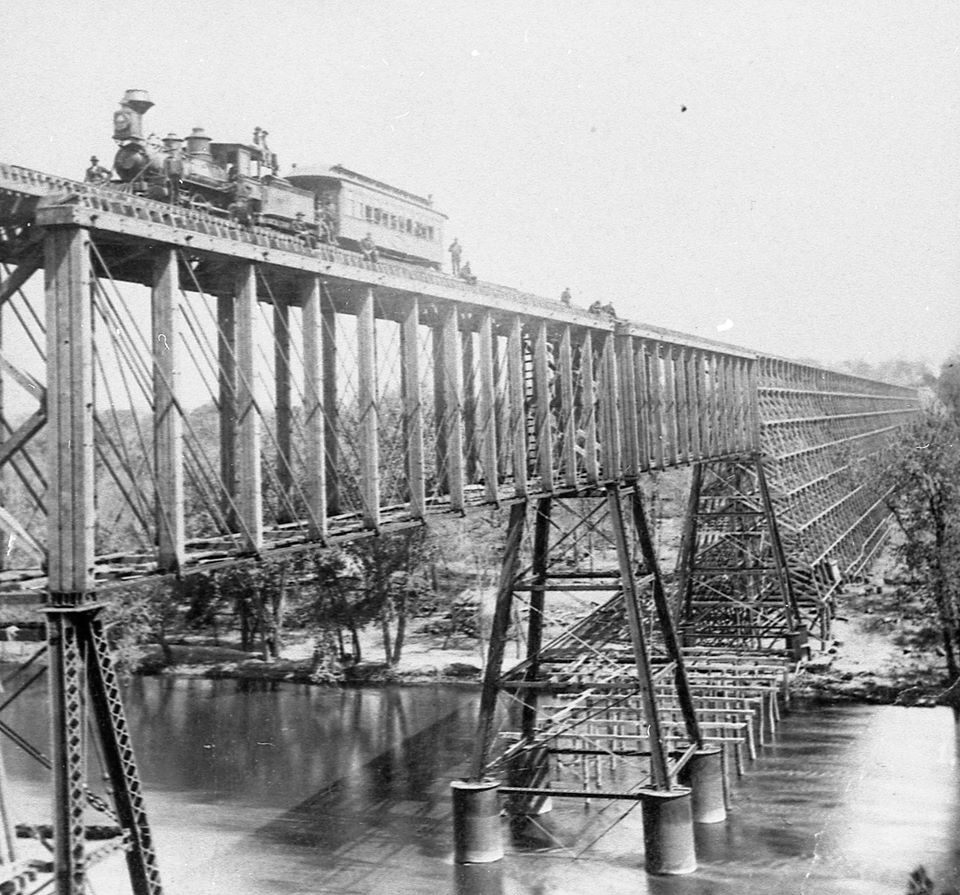
In 1855, the railroad became the focus and many rail lines connected communities. The push for the first rail line to cross east to west helped determine, in later years, where the Lincoln Highway could run and paralleled that rail line.
The Anderson Law, in 1902, created the first State Highway Commission, which was a research entity at Iowa State College in Ames. The commission did mostly data collection, planning, and public education but it did reverse the idea of local-control thinking. Seven counties made notable progress in road improvements – Carroll, Clinton, Dubuque, Lee, Marshall, Scott, and Greene. In 1904-05 technical specifications for earthen roads were developed as well as how to survey and build culverts.
Greene County was often used by the commission as a place to demonstrate new technology and projects. In 1906, Greene County had 20 reinforced bridges and by 1907-1909, 175 miles of good gravel roads.
As the Lincoln Highway was being developed, Iowa still had many dirt roads and travelling in the rainy season led to problems with mud. The Lincoln Highway paralleled the Chicago Northwestern tracks as they had already found the driest, less hilly parts of the state going east to west. Captain Albert Head (known for banking and real estate) donated $1,000 for the bridge over Buttrick’s Creek. Greene County was one of the first counties to develop drainage districts. By 1912, tiling began to drain wetlands to be used for farming and improving roads. In 1913, the Eureka Bridge over the Raccoon River project asked for private donations of $5,000 from Greene County residents and $15,000 from the Board of Supervisors. Greene County had to adjust alignment with the road coming from Boone County as they did not match. In 1919, Greene County was the first to accept Federal funds for paving. Besides the “seedling mile” outside of Marion, Greene County was the first to pave their portion of the Lincoln Highway. The paved portion ran 6 ½ miles equidistant from the center of Jefferson.
There were two hazardous spots on Greene County’s Lincoln Highway. One was a zigzag at Buttrick’s Creek, east of Jefferson. It became a smooth S-curve incorporating the new Head Memorial Bridge. The other hazard was at Danger Hill, on the west side of the Raccoon River, where the steep grade was reduced to 6% and produced a fifteen-foot road cut, considered “spectacular” for Iowa at the time. Previously, cars often had to go backwards up Danger Hill as they did not have fuel pumps to keep the gas flowing to the engine. Fuel pumps had not been invented yet.
In 1924, paving of the 30 miles of the Lincoln Highway in Greene County was completed.
Current plans are for the overpass where the Lincoln Highway departs from Highway 30, just outside of Grand Junction, to be reconstructed and the pilings moved to the nearby Lion’s Tree Park. Interpretation already exists there about the history of Iowa and road development, the automobile, and the different alignment the Lincoln Highway has taken in Green County. Added to it will be interpretation about the overpass and the current reconstruction.
Other towns in Greene County
Churdan
Churdan was built in 1882 as the north and south railroad was built. The rail line pushed through into Fonda by the Wabash, St. Louis and Pacific Railroad on the narrow gauge. Spirit Lake is the northern terminal of this line. The town was named after James Churdan, an early settler and the first postmaster. In 1907, there were a cement block and tile business and a brick and tile business in town.
Cooper
This is an unincorporated town and was located and laid out by the Polk and Hubbell Development Company in 1881. It was named for Isaac Cooper, a Des Moines pioneer and Hubbell’s father-in-law.
Dana
In 1879, Samuel Dana founded the town and named it for himself. It was noted to be one of the best shipping stations on the rail line that passed through town. It suffered 3 major fires in the early years, but always recovered. A cooperative cheese factory was built in 1898. In 1904, it caught on fire. It was rebuilt in 6 weeks and ran profitably until December 26, 1906 when it closed on account of a prevailing sickness and by order of the board of health, $745 worth of cheese ordered burned.
http://files.usgwarchives.net/ia/greene/history/dana.txt
Paton
Town was named for William Patton, a native Scotsman, who immigrated to New York City and became the head of Paton and Co. He and his family were instrumental in a trust fund created to start a library in Paton. He also offered to build a Presbyterian Church in Paton and provided a bell for the tower.
Today, Paton’s businesses include the 209 Main Bar and Grill, owned by Vaughn Bauer of Bauer Built Manufacturing, an ag equipment business. He started it as a place to entertain clients and for the residents of Paton. The décor inside is metal art made at the plant, where the usual product is planters and tool bars that fit planters for John Deere and Company. (209 S Main, 515-968-9109).
Rippey
This town is named for an early settler, Judge Robert M. Rippey, who was active in the organization and development of the county. The original town became known as Old Rippey which, in 1855, was on the stagecoach route. In 1870, New Rippey was created 3 miles from the route of the Des Moines and Ft Dodge Railroad (in 1887 known as the Chicago, Rock Island, and Pacific). New Rippey prospered and Old Rippey faded.
Today, an annual bike ride called “BRR” (Bike Ride to Rippey) is held the first Saturday in February. The ride has been held for over 30 years and is a 24-mile ride from Perry, IA to Rippey and back. BRR indeed! www.facebook.com/BikeRidetoRippey