Harrison
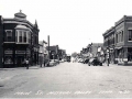
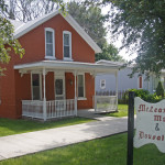
Woodbine, Iowa © Mike Whye
Harrison County
This county lies along the Missouri River. The topography changes from low, flat flood plains along the Missouri River to the Loess Hills (wind deposited soil from the last ice age) that run north and south through the county and then to rolling hills in the east. The Boyer River winds through these eastern hills and drains to the west into the Missouri River. Original inhabitants were the Omaha, Pottawattamie, Sioux and Winnebago. In 1804, Lewis and Clark were the first Americans in what would later become Harrison County. With the settler movement westward, Indians were soon displaced.
Originally Harrison County was part of K eokuk County and was established as its own county in 1851. Commissioners were appointed to locate a county seat and the name was to be Magnolia. The county was named for the 9th President, William Henry Harrison. The commissioners chose a location and named the town Magnolia as they were instructed. Other locations were claiming to be the county seat. Daniel Brown wanted it at a location he had platted and called Calhoun. Another faction wanted it on the other side of the Boyer River where Logan now stands. Missouri Valley also wanted to be the county seat.
The first government was under the old County Judge system- a single officer was to locate roads, build bridges levy taxes, and build a courthouse. In 1861, a Board of County Supervisors was created to take over these duties. Each of the 20 townships within the county elected a supervisor. With so many members and differences of opinion, it was hard to get anything accomplished. In 1871, the county was divided into 3 districts and a Board of Supervisor elected from each.
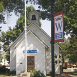
Lincoln Highway Heritage Byway Merrybrook Museum in Woodbine, Iowa
By 1875, Logan had grown and had the balance of power and business. By a narrow margin of 2 votes, Logan won the county seat designation from Magnolia. A new courthouse was built and the records moved to Logan.
Some of the early settlers were Mormons who came westward from Nauvoo, Ill. Their leader, Joseph Smith, had been killed by an angry mob in 1844 and the new leader, Brigham Young, brought them west. The Mormon Trail runs further south than Harrison County, but some Mormons did settle in the county at Little Sioux by 1860. A few years later, in 1867, the first railroad spanning Iowa from Clinton to Council Bluffs was completed and that made life easier for new settlers and for existing residents.
Lincoln Highway Heritage Byway McLean Museum in Dunlap, Iowa © Mike Whye
The town was platted in 1867 and named for George L. Dunlap, a railroad manager for the CNW Railroad in Illinois and Wisconsin. Today the Historical Society owns the McLean Museum, the Dougal House, and then Dunham Barn one mile west of town. The McLean building was once a church and the Dougal, a parsonage. The Barn is on the National Register of Historic Places. During the 4th of July, Dunlap celebrates with a Barn Festival complete with horse rides and demonstrations of pioneer crafts.
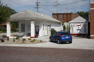
Brick Street Station in Woodbine. ©Mike Whye
Lorenzo Butler was one of the first settlers here in 1849 and ran a small store along the Boyer River and a post office was inside his store. His wife served as the postmistress and had the opportunity to name the post office. There are 3 version of how the name came about. One version is that Mrs. Butler named it for her birthplace in England. Another version says perhaps she was homesick and chose “Woodbine” as the flowering plant grew outside her home in England. The third version states that the woodbine plant, or Virginia creeper, was plentiful in Harrison County. Perhaps it is a combination of all these ideas.
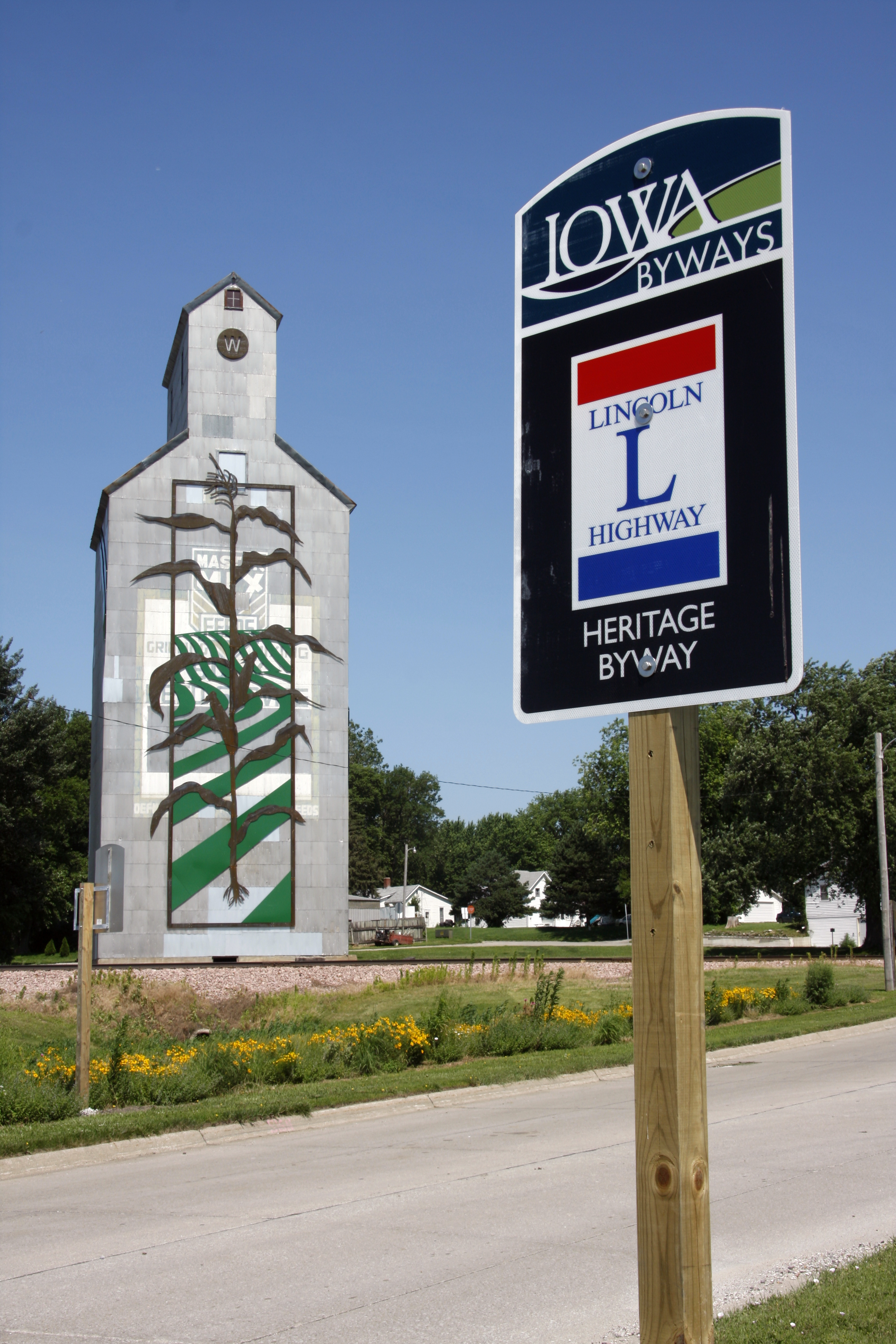
Today, Woodbine is undergoing historic façade renovations on 23 main street buildings. The downtown, the Carnegie Library, and the eleven blocks of bricked Lincoln Highway are all on the National Register of Historic Places. Entering town from the South, a large metal cornstalk sculpture on the grain elevator captures your eye. This is a much-photographed subject. The Main Street District is continuing to focus on art with a sculpture competition in the District.
Woodbine celebrates Applefest on the last Saturday in September.
Attractions in Woodbine
- White’s Floral Garden
- Zell Millard Historic Preservation Park- includes Merry Brook Rural School Museum, Harrison County Genealogical Society, the original Depot, a CNW caboose, and a renovated 1928 canopy gas station serving as a Welcome Center and community meeting room.
- Tommy Gate- designed the original hydraulic lift and still manufactures it in Woodbine

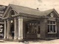
State Savings Bank in Logan, Iowa
Henry Reel, from Virginia, settled on the banks of the Boyer River in 1852. Reel and his sons started a grist mill and saw mill, which was the beginning of Boyer Falls. This area was later renamed Logan after General John A. Logan, a Civil War officer. In 1867, Reel set aside land for the town of Logan. In 1910, a new courthouse was built and it is still in use today.
Attractions in Logan:
- DeSoto National Wildlife Refuge
- Harrison County Historical Village and Welcome Center
- Museum of Religious Arts
- Sawmill Organic Farms
- Schaben’s Park
- Small’s Fruit Farm Willow Lake Recreational
- Willow Lake Recreational
- Wilson Island Recreational Area
- Wisecup Farm Museum
Information courtesy of the Logan website.
Lincoln Hihgway Heritage Byway Logan Museum of Religious Arts © Francie O’Leary
This town was first known as St. John’s Township and was about 1 mile south of the present location. The residents tried and tried to bring the railroad through, but the Chicago Northwestern went north to avoid the low level land. This development was largely due to John I. Blair, one of the most prominent railroad promoters. St John’s moved to be closer to the railroad and was renamed Missouri Valley in 1871. Eventually it became the intersection of 3 railroads- the Cedar Rapids RR, the Missouri River RR (later became the Chicago and Northwestern), and the Sioux Valley RR.
Every year the town celebrations include the Harrison County Fair, Harvest Fest Kid’s Celebration, a Gospel Sing, and several car shows/swaps.
Three Scenic Byways intersect in Missouri Valley -the Lincoln Highway Heritage Byway, the Loess Hills Scenic Byway and Western Skies Scenic Byway.
Of interest is the nearby Loess Hills Lavender Farm.
Harrison County and the Lincoln Highway
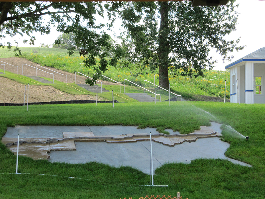
Lincoln Highway Interpretive Site under construction, August 2010. ©Prairie Rivers of Iowa
In 1921, Woodbine’s stretch of the Lincoln Highway – all 11 blocks, were bricked. It is the largest remaining original portion in Iowa. A canopy of old trees shade turn-of-the-century family homes as the Lincoln Highway passes from the residential area to the business district. This portion of the Lincoln Highway is listed on the National Register of Historic Places.
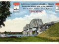
In 1958, a new bridge was constructed over the Missouri River and US 30 was re-routed from Missouri Valley to the new bridge and into Blair, NE. The original Lincoln Highway, today, still continues to Council Bluffs where it crosses the Missouri River into Omaha, NE. The original route to Council Bluffs is marked by the Iowa Department of Transportation as the “Lincoln Highway Heritage Byway” as it is in all 13 counties it travels through in Iowa.
Other town in Harrison County
Platted in 1855, the residents had to depend on the rail station at River Sioux (a now defunct town) for their transportation. The station was a mile away. In 1882, the residents comprised of 140 Mormons, 100 Catholics, 24 Methodists, and 35 Universalists.
Today, between Little Sioux and Pigsah is the Little Sioux Unit of the Loess Hills State Forest. This area also is home to the Little Sioux Scout Ranch of the Boy Scouts of America.
It is said Magnolia is situated upon high rolling land, gradually sloping in all direction and finally merging into pleasant valleys. It was established in 1851 and was originally chosen as the county seat. The third building erected was for a courthouse and it still stands today. It is on the National Register of Historic Places. When the Northwestern Railroad located near Logan, Magnolia’s hopes to become a big town were dashed.
- Modale
The town was originally called Martinsdale and was laid out in 1872 by Benjamin Martin. When the railroad depot was built, it was renamed Modale because of the city’s setting in a dale near the Missouri River.
- Mondamin
In the winter of 1867-68, the railroad finally extended to this point and the town was platted. Mondamin comes from the name for a Native American corn deity. The Mondamin Unit of the Loess Hills State Forest is 3 miles east of town.
- Persia
The town was established in 1882 and may have been named for Persian railroad workers or for David Persia who lived near the Persian water tower or maybe named for a Persian peddler who roamed the area.
- Pigsah
Pigsah was laid out if 1899. The name was chosen by members of the Church of Jesus Christ of Latter-day Saints (Mormons). They had established a temporary settlement in Iowa near a hill they christened Mount Pigsah which is located in southern Iowa. The Mormons used the same name for this community.
The Old Home Café in Pigsah was made famous by C.W. McCall in the Old Home Bread commercial and song, “Old Home Filler-up and Keep on Truckin Café”.