
Carroll
Carroll County
Carroll County was named after Charles Carroll of Carrollton, MD who was the only Roman Catholic to sign the Declaration of Independence. © Francie O’Leary
Carroll County was named after Charles Carroll of Carrollton, MD who was the only Roman Catholic to sign the Declaration of Independence. In 1858, a courthouse was built in the town of Carrollton and it served as the county seat until 1869 when the Chicago and Northwestern laid out the town of Carroll City to the north and west of Carrollton. A vote was taken and 88 ayes and 30 nays moved the courthouse and county seat to Carroll City. In 1875, Carroll City was renamed, Carroll.
Carrollton declined over the years and several of the buildings were moved to the country to be used as stables and other outbuildings. When Coon Rapids was built near the St. Paul Railroad, any hope Carrollton had for importance were dashed. Today, the Carrollton Community Heritage Club oversees the Carrollton Cemetery and hopes to restore the prairie and buildings to tell the story of the early settlers and the community.
Carroll County and the Lincoln Highway
Railroads were important to the development of Carroll County. The county seat and courthouse moved due to the location of the railroad and new towns were platted within close proximity to railroads. Farm- to-market roads became necessary to get produce to the rail lines and supplies from the railway station to the local farms and businesses. As the automobile developed, the best driving routes often aligned with these rail lines. Carroll County was one of 13 counties selected in Iowa due to the Chicago and Northwestern railroad and the road that ran beside it from Ralston, to Glidden, to Carroll, by Arcadia and on to Crawford County.
Indian History
“Before the county was settled, there was a warpath that extended north to south through the county. It separated the Pottawatomie and Mesquakie from the Sioux. Sioux warriors chased a buffalo over the lane and the battle began.
At Swan Lake, which was more of a marsh at the time, three hundred Pottawatomie were hidden in ambush on the southeast side of the lake. Seven hundred Sioux advanced from the west. Rifles were used until the ammunition gave out and bow and arrows were used until the arrows were expended. The furious onslaught continued in hand to hand combat with tomahawks.
This was a battle to the end. Indian legend relates that three Pottawatomie and one Sioux survived. Early trappers and hunters reported the ground was white with bleached bones, rusted rifles and weapons.”
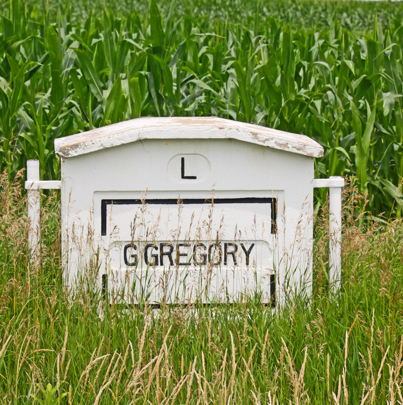
Moss Marker west of Ralston © Angie Tomka
Towns along the Lincoln Highway in Carroll County
City of Ralston
Ralston was incorporated in 1903 and today has only 79 residents. It boasts of a 12 million gallons biodiesel production facility which was built and became operational in 2001.
Glidden is most noted as the home of the first American soldier killed in World War I, Merle D. Hay. He is buried in the cemetery in Glidden. An estimated 10,000 to 20,000 crowd attended services for him on July 24, 1921. That was quite a load for a town of 900 people. The Iowa Legislature passed a bill funding the monument which stands in front of the cemetery. It stands eight feet high and has a cartoon done by Ding Darling sandblasted into the front of the granite monument.
An ongoing argument has ensued about the location of the Lincoln Highway in/near Glidden. In some accounts, like the Auto Club’s Blue Book and The Glidden Graphic , the Lincoln Highway went down Main Street in Glidden ( also known as Idaho Street). Other accounts say the route went to the north of town. In January 1914, engineers came who would lay out the route met in Carroll and four carloads of Glidden boosters went to Carroll to confer with them on what route they would take in Glidden. On February 12, 1914, the word came that route was to go to the north of town. Old-timers in town still say the route went down Main Street. In 1994, street light standards were painted with the Lincoln Highway logo. Detroit bureaucracy may have determined the north route, but it seems the residents used and referred to Main Street as the route.
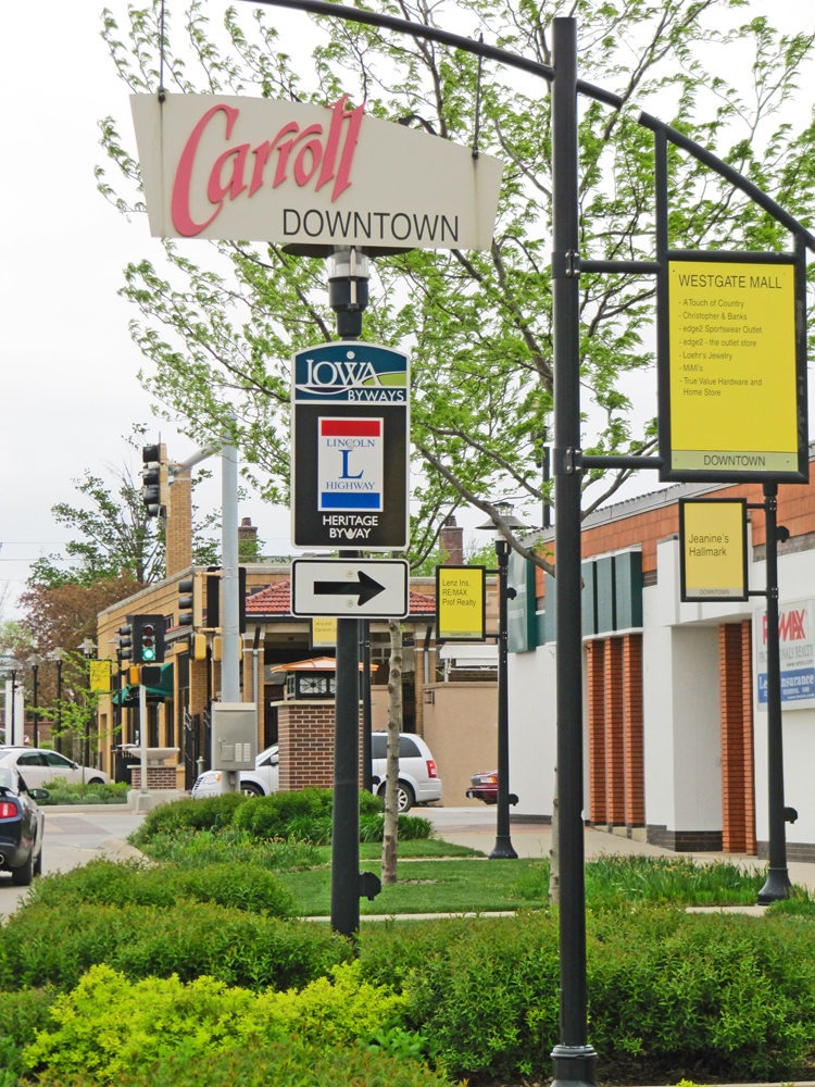
Carroll (City) became the county seat in 1869 after being laid out by the Chicago and Northwestern railroad. It took the designation away from the town of Carrollton. A courthouse was built on the town square but burned down in 1886. A new stone and brick building was built with a clock tower and used as the courthouse for over 75 years. It was built on the northwest corner of the town square (now a parking lot). A newer courthouse was built in 1965 on the square and the bell from the previous clock tower now sits on the courthouse grounds.
Arcadia is located on the Mississippi-Missouri divide and is among the highest in the state at 1429 feet above sea level. After the Civil War and by 1867, the Chicago Northwestern Railroad entered Council Bluffs and established a switch station to the east of Arcadia, called Eastside, and a switch station to the west, called Westside. Where the town of Arcadia is today, it was named Tip Top. A wealthy New Englander, Mr. Isaac Newton Voris, was traveling the train from California to New York and was so impressed with the land that he bought 4,000 acres, platted the town, and by 1871 persuaded the railroad to change the name to Arcadia.

The Carroll Depot was designed by Charles Sumner Frost © Mike Whye
Attractions in Carroll County
The Carroll Depot was designed by Charles Sumner Frost, who designed over 200 rail depots for the Chicago Northwestern. His other notable works include the Chicago Navy Pier and the Navy Pier Terminal. First built in 1867, it burned down and was rebuilt in 1896, restored in 1990, and is used as an office by the Carroll Chamber of Commerce today. There are two other buildings at the depot and restoration is currently underway on them.
In 1949, the Carroll Stadium was built in the Merchants Park for Carroll’s semi-pro team, the Merchants. Restoration work is planned for the stadium. In 2010, a Lakers Basketball Court was placed in the Veteran Memorial Park. The court was donated by the Los Angeles Lakers (formerly the Minnesota Lakers) to honor the 50th year of a near fatal plane crash there. In 1960, the DC-3 plane carrying 10 Minnesota Lakers and 13 other people made an emergency landing in a cornfield. All survived. Just the year before (1959), Buddy Holly and Ritchie Valens died in a plane crash at Clear Lake, Iowa.
The Carnegie Library is located at the corner of the Lincoln Highway and Court Street and is now home to the Carroll County Historical Society. The Society also manages a log cabin and schoolhouse in Graham Park and a Farmstead Museum at Swan Lake State Park. Call 712-792-1512 for an appointment or the museum at 712-792-1582 for the summer schedule.
Swan Lake State Park is a 510 acre multi-use park that includes a 110 acre lake. Camping, picnicking, fishing, sledding, cross country skiing, and snowmobiling are just a few of the activities in the park.
Sauk Rail Trail runs from Swan Lake State Park and Black Hawk State Park. It is 33 miles of native prairies, wetlands, farmland, and timber areas. Most of the trail is on an abandoned rail bed.
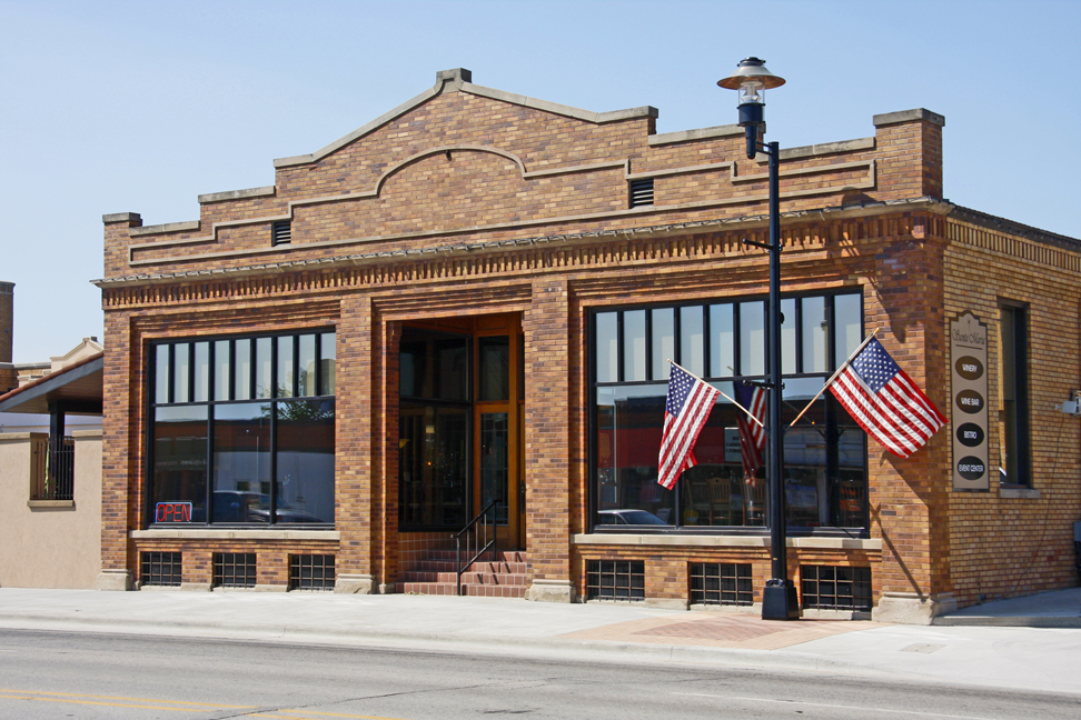
The Santa Maria Winery began as a home based business for John Guinan in Omaha, NE. © Mike Whye
The Santa Maria Winery began as a home based business for John Guinan in Omaha, NE. After the children were raised, he and his wife, Rose, moved to Carroll to be near her hometown. John was tired of the corporate world and wanted to make his hobby into a business. They selected land near St. Mary’s church in Willey. A machine shed served as the first winery. One day in 2008, as the couple drove past the old Wittrock auto dealership in Carroll, they decided it would make a great winery. They renovated the building and made it complete with an event center tasting room, and restaurant. A few years later, Santa Maria Winery decided to focus on wine making instead and now only operates a winery in the space. As a salute to the Lincoln Highway that runs right in front of the building, the Santa Maria Winery offers a semi-sweet red wine called the Lincoln Highway. It is a “blend of refreshing cherry, raspberry and wild plum flavors with a pleasantly smooth finish”.
The St. Anthony Regional Hospital was started by the visioning of Father Joseph Kuemper. He had been a priest out East and a professor at the College of Dubuque (now Loras College). He came to the Carroll area as the pastor of the SS Peter and Paul Church. In 1901, he used his own money to purchase land and gave $1,000 to the Franciscan Sisters of Perpetual Adoration, from LaCrosse, Wisconsin, if they would manage and run a fully equipped hospital. The Sisters agreed and he built the hospital for them.
Kuemper High School’s roots go back to Father Joseph Kuemper too. In 1908, he started the St. Angela Domestic Institute as an all-girl boarding school designed to educate young women in the art of Christian homemaking. The institute continued until 1954, when it closed. Under Father Lenz, 10 area parishes invested in and financially supported a new non-tuition, co-educational high school. Catholic grade schools began consolidating in 1964 and by 1996 all K-8 schools in Carroll were merged into one Catholic school.
Other Towns in Carroll County
- Templeton (home of Templeton Rye)
- Manning which has a German Hausbarn that was brought from Germany and reassembled in Manning in 1999. Manning also has the Leet-Hessler Farmstead with 8 farm buildings from 1910 showcasing early farm life in the area.
- Breda
- Coon Rapids
- Dedham
- Halbur
- Lanesboro
- Lidderdale
- Willey


